MAPWaters Act of 2025
Summary
What This Bill Does
The bill defines key terms for federal waterway access data standardization including Federal fishing restriction, Federal land or water management agency, Federal waterway, and Secretaries, mandates interagency geospatial data standards for federal waterway access and fishing restrictions within 30 months, and requires agencies to digitize and publicly publish GIS data on waterway restrictions, access points, fishing closures, and bathymetric data within 5 years, with twice-yearly updates. It relies on reporting requirements, compliance mandates, definition changes, and grants. The main policy areas are Public Lands, Social Welfare, Technology, and Agriculture.
Who Benefits and How
Recreational boaters and anglers could face fewer barriers, Technology and geospatial data companies could gain revenue opportunities, and Outdoor recreation industry (marinas, outfitters, guides) could gain revenue opportunities.
Who Bears the Burden and How
Federal land and water management agencies would take on compliance duties, Department of the Interior and Department of Agriculture would take on compliance duties, and United States Geological Survey would take on compliance duties.
Key Provisions
- Defines key terms for federal waterway access data standardization including Federal fishing restriction, Federal land or water management agency, Federal waterway, and Secretaries.
- Mandates interagency geospatial data standards for federal waterway access and fishing restrictions within 30 months.
- Requires agencies to digitize and publicly publish GIS data on waterway restrictions, access points, fishing closures, and bathymetric data within 5 years, with twice-yearly updates.
- Authorizes Secretaries to partner with non-federal agencies, private sector, and nonprofits, and to enter third-party agreements to carry out the Act.
- Requires annual progress reports to Congressional committees through March 2034.
Evidence Chain:
This summary is generated from the full bill text using AI analysis. Expand "Detailed Analysis" below for identified beneficiaries/burden bearers with clause-level evidence links.
At a Glance
What This Bill Does
The bill defines key terms for federal waterway access data standardization including Federal fishing restriction, Federal land or water management agency, Federal waterway, and Secretaries, mandates interagency geospatial data standards for federal waterway access and fishing restrictions within 30 months, and requires agencies to digitize and publicly publish GIS data on waterway restrictions, access points, fishing closures, and bathymetric data within 5 years, with twice-yearly updates.
Key Policy Areas
Public Lands, Social Welfare, Technology, Agriculture
Primary Purpose
The bill defines key terms for federal waterway access data standardization including Federal fishing restriction, Federal land or water management agency, Federal waterway, and Secretaries, mandates interagency geospatial data standards for federal waterway access and fishing restrictions within 30 months, and requires agencies to digitize and publicly publish GIS data on waterway restrictions, access points, fishing closures, and bathymetric data within 5 years, with twice-yearly updates.
Policy Domains
Whole bill
Identified Gains
- Recreational boaters and anglers
- Technology and geospatial data companies
- Outdoor recreation industry (marinas, outfitters, guides)
- Commercial fishing operators
- Historic and archaeological resource managers
Identified Costs
- Federal land and water management agencies
- Department of the Interior and Department of Agriculture
- United States Geological Survey
- Federal land and water management agencies (BLM, NPS, BOR, USFWS, USFS)
Sponsors
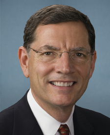
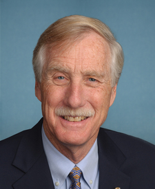
Legislative Progress
In CommitteeMr. Barrasso (for himself and Mr. King) introduced the following …
Read twice and referred to the Committee on Energy and …
Introduced in Senate
Stakeholder Effects
cui bono?How this legislation distributes effects. Mention counts reflect frequency, not effect magnitude.
Department of the Interior and Department of Agriculture, Federal land and water management agencies, State and federal regulatory agencies
Outdoor recreation industry (marinas, outfitters, guides), Recreational boaters and anglers
Bill Structure & Actor Mappings
Who is "The Secretary" in each section?
We use a combination of our own taxonomy and classification in addition to large language models to assess meaning and potential beneficiaries. High confidence means strong textual evidence. Always verify with the original bill text.
Learn more about our methodology