Gunnison Outdoor Resources Protection Act of 2025
Summary
What This Bill Does
The bill establishes a comprehensive set of definitions for the Gunnison Outdoor Resources Protection Act, including terms for collaboratively developed projects, covered areas (SMAs, WCAs, Protection Areas, Recreation, requires designates nine Special Management Areas in Gunnison County totaling approximately 214,650 acres of federal land managed by the Forest Service and BLM, with the purpose of conserving natural, scenic, and requires designates eight Wildlife Conservation Areas in Gunnison County totaling approximately 223,865 acres, focused on conserving, protecting, enhancing, and restoring wildlife and wildlife habitat. It relies on compliance mandates, product standards, trade restrictions, and exemptions. The main policy areas are Public Lands, Social Welfare, Environment, and Agriculture.
Who Benefits and How
Gunnison sage-grouse and other wildlife species would be affected, Conservation and wilderness preservation organizations would be affected, and Ute Mountain Ute Tribe could gain revenue opportunities.
Who Bears the Burden and How
U.S. Forest Service would take on compliance duties, Bureau of Land Management would take on compliance duties, and Off-highway vehicle users could face higher barriers.
Key Provisions
- Establishes a comprehensive set of definitions for the Gunnison Outdoor Resources Protection Act, including terms for collaboratively developed projects, covered areas (SMAs, WCAs, Protection Areas, Recreation...
- Requires designates nine Special Management Areas in Gunnison County totaling approximately 214,650 acres of federal land managed by the Forest Service and BLM, with the purpose of conserving natural, scenic...
- Requires designates eight Wildlife Conservation Areas in Gunnison County totaling approximately 223,865 acres, focused on conserving, protecting, enhancing, and restoring wildlife and wildlife habitat.
- Requires designates two Recreation Management Areas in Gunnison County: Double Top (14,734 acres) and Horse Ranch Park (3,513 acres).
- Amends the Colorado Wilderness Act of 1993 to designate approximately 124,898 acres of new wilderness areas and wilderness additions in the Grand Mesa, Uncompahgre, and Gunnison National Forests.
Evidence Chain:
This summary is generated from the full bill text using AI analysis. Expand "Detailed Analysis" below for identified beneficiaries/burden bearers with clause-level evidence links.
At a Glance
What This Bill Does
The bill establishes a comprehensive set of definitions for the Gunnison Outdoor Resources Protection Act, including terms for collaboratively developed projects, covered areas (SMAs, WCAs, Protection Areas, Recreation, requires designates nine Special Management Areas in Gunnison County totaling approximately 214,650 acres of federal land managed by the Forest Service and BLM, with the purpose of conserving natural, scenic, and requires designates eight Wildlife Conservation Areas in Gunnison County totaling approximately 223,865 acres, focused on conserving, protecting, enhancing, and restoring wildlife and wildlife habitat.
Key Policy Areas
Public Lands, Social Welfare, Environment, Agriculture
Primary Purpose
The bill establishes a comprehensive set of definitions for the Gunnison Outdoor Resources Protection Act, including terms for collaboratively developed projects, covered areas (SMAs, WCAs, Protection Areas, Recreation, requires designates nine Special Management Areas in Gunnison County totaling approximately 214,650 acres of federal land managed by the Forest Service and BLM, with the purpose of conserving natural, scenic, and requires designates eight Wildlife Conservation Areas in Gunnison County totaling approximately 223,865 acres, focused on conserving, protecting, enhancing, and restoring wildlife and wildlife habitat.
Policy Domains
Gunnison Outdoor Resources Protection Act of 2025
Identified Gains
- Gunnison sage-grouse and other wildlife species
- Conservation and wilderness preservation organizations
- Ute Mountain Ute Tribe
- Conservation organizations
- Conservation and wildlife organizations
Identified Costs
- U.S. Forest Service
- Bureau of Land Management
- Off-highway vehicle users
- Oil and gas exploration and production companies
- Mining companies seeking mineral exploration and extraction
Sponsors
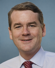
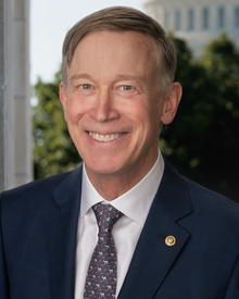
Legislative Progress
In CommitteeCommittee on Energy and Natural Resources Subcommittee on Public Lands, …
Mr. Bennet (for himself and Mr. Hickenlooper) introduced the following …
Read twice and referred to the Committee on Energy and …
Introduced in Senate
Stakeholder Effects
cui bono?How this legislation distributes effects. Mention counts reflect frequency, not effect magnitude.
Backcountry hikers and non-motorized recreation, Grand Traverse skiing event organizers, Motorized recreation vehicle users and operators
Positive-direction: Backcountry hikers and non-motorized recreation, Grand Traverse skiing event organizers, Outdoor recreation industry (hiking, cycling, trail-based tourism), Outdoor recreation industry (hiking, skiing, cycling)
Negative-direction: Motorized recreation vehicle users and operators, Off-highway vehicle users, Off-highway vehicle users and recreational motorized vehicle industry, Snowmobile operators
Bureau of Land Management, Forest Service, U.S. Forest Service and Bureau of Land Management
Conservation and environmental organizations, Conservation and wilderness preservation organizations, Conservation and wildlife organizations
Coal mine operators (methane capture exemption), Mining companies seeking mineral exploration and extraction, Mining companies seeking mineral exploration on federal land
Positive-direction: Coal mine operators (methane capture exemption)
Negative-direction: Mining companies seeking mineral exploration and extraction, Mining companies seeking mineral exploration on federal land
North Fork Valley watershed communities and agricultural interests, Ranchers with existing federal grazing permits
Indian Tribes with treaty rights in the area, Ute Mountain Ute Tribe
Commercial timber harvesting companies, Timber harvesting companies
Bill Structure & Actor Mappings
Who is "The Secretary" in each section?
- "the_secretary"
- → Secretary of Agriculture (via Forest Service Chief) for National Forest System land; Secretary of the Interior for BLM land
Note: The Secretary refers to either the Secretary of Agriculture (Forest Service) or Secretary of the Interior (BLM) depending on the land jurisdiction, as defined in Section 2.
Key Definitions
Terms defined in this bill
A project developed through a collaborative process with multiple diverse stakeholders that is transparent and nonexclusive, or meets resource advisory committee requirements.
Gunnison County, Colorado.
Secretary of Agriculture (via Forest Service Chief) for National Forest System land; Secretary of the Interior for BLM land.
Each of the Special Management Areas, Wildlife Conservation Areas, Protection Areas, Recreation Management Areas, and the Scientific Research and Education Area.
Reestablish native vegetation, restore drainage and watershed function, block vehicular traffic, and implement invasive species monitoring on a road.
A decision designating roads, trails, or areas for over-snow vehicle use under applicable Forest Service or BLM regulations.
Land within a covered area within 1/4 mile of interface/intermix areas mapped in the USDA 2010 Wildland-Urban Interface publication.
We use a combination of our own taxonomy and classification in addition to large language models to assess meaning and potential beneficiaries. High confidence means strong textual evidence. Always verify with the original bill text.
Learn more about our methodology