Oregon Owyhee Wilderness and Community Protection Act
Summary
What This Bill Does
The Oregon Owyhee Wilderness and Community Protection Act sets a detailed land-management framework for Malheur County, Oregon. It defines covered federal lands managed by the Bureau of Land Management, creates the Malheur County Grazing Management Program, and gives authorized grazing permittees and lessees operational flexibility for seasonal livestock positioning and water-source placement with notice. It establishes the Malheur C.E.O. Group with grazing, business, conservation, Burns Paiute Tribe, and Fort McDermott Tribe representatives to propose projects on federal, water, and non-federal lands. It designates approximately 23,431 acres as the Keeney Creek Special Management Area and approximately 17,443 acres as the Clark Ranch Special Management Area, with management purposes that protect invasive-species control, fire suppression, livestock production, and tribal cultural access. It designates wilderness areas and limits new permanent roads while allowing specified motorized or mechanized uses for official, emergency, national-defense, rangeland, habitat, livestock, fence, and water-infrastructure purposes. It directs Interior to accept specified Jonesboro Ranch, state, and private lands into trust for the Burns Paiute Tribe when conveyed, and to seek a co-stewardship agreement with the Tribe for the Castle Rock area. It also preserves wildfire, invasive-species, and livestock-management authority on covered federal lands.
Who Benefits and How
Authorized grazing permittees and lessees benefit from flexibility to adjust seasons and water-source placement when weather, forage, fire, drought, or other conditions change. Malheur County stakeholders benefit from a formal C.E.O. Group that includes grazing, business, conservation, Burns Paiute, and Fort McDermott representation. The Burns Paiute Tribe benefits from trust-land treatment for specified ranch and state parcels and from a required effort to create Castle Rock co-stewardship. Conservation interests benefit from wilderness and special management area designations. Tribal cultural users, fire managers, invasive-species crews, and livestock operators benefit because the bill explicitly preserves access or management activities that might otherwise be uncertain after land designations.
Who Bears the Burden and How
Interior and BLM land managers must administer the grazing program, analyze operational-flexibility alternatives, manage special management areas and wilderness areas, prepare maps, process trust acquisitions, and negotiate co-stewardship. New road builders, developers, and mineral lease applicants face tighter constraints on lands designated as wilderness or special management areas. Grazing permittees seeking flexibility must provide written notice and operate under monitoring plans and rangeland standards. Malheur C.E.O. Group members must meet, maintain consensus rules, and propose eligible projects. Federal taxpayers fund agency administration, mapping, coordination, and land-management work.
Key Provisions
- Establishes the Malheur County Grazing Management Program for operational flexibility on BLM land.
- Creates the Malheur C.E.O. Group with grazing, business, conservation, Burns Paiute Tribe, and Fort McDermott Tribe representation.
- Designates Keeney Creek and Clark Ranch Special Management Areas with protections for fire suppression, invasive-species control, livestock production, and tribal cultural access.
- Designates wilderness and limits new permanent roads while preserving specified official and emergency uses.
- Directs Interior to accept specified lands into trust for the Burns Paiute Tribe and seek Castle Rock co-stewardship.
- Protects wildfire control, invasive-species control, and livestock production across covered federal lands.
Evidence Chain:
This summary is generated from the full bill text using AI analysis. Expand "Detailed Analysis" below for identified beneficiaries/burden bearers with clause-level evidence links.
At a Glance
What This Bill Does
Creates a Malheur County public-lands framework for Oregon Owyhee lands by authorizing grazing flexibility, establishing the Malheur C.E.O. Group, designating special management and wilderness areas, accepting Burns Paiute Tribe land into trust, creating a Castle Rock co-stewardship area, and protecting wildfire, invasive-species, and livestock-management activities.
Key Policy Areas
Public Lands, Agriculture, Tribal Nations, Conservation, Interior
Primary Purpose
Creates a Malheur County public-lands framework for Oregon Owyhee lands by authorizing grazing flexibility, establishing the Malheur C.E.O. Group, designating special management and wilderness areas, accepting Burns Paiute Tribe land into trust, creating a Castle Rock co-stewardship area, and protecting wildfire, invasive-species, and livestock-management activities.
Policy Domains
Substantive provisions
Identified Gains
- Authorized grazing permittees
- Malheur County stakeholders
- Burns Paiute Tribe
- Fort McDermott Tribe
- Conservation organizations
- Fire managers
Identified Costs
- Interior Department land managers
- BLM Vale District staff
- New road builders
- Mineral lease applicants
- Grazing permittees seeking flexibility
- Federal taxpayers
Sponsors
Legislative Progress
In CommitteeReferred to the House Committee on Natural Resources.
Introduced in House
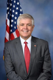
Mr. Bentz introduced the following bill; which was referred to …
Stakeholder Effects
cui bono?How this legislation distributes effects. Mention counts reflect frequency, not effect magnitude.
BLM Vale District staff, BLM land managers, Fire suppression crews
Positive-direction: Fire suppression crews
Negative-direction: BLM Vale District staff, BLM land managers, Interior appointment staff, Interior land managers, Interior trust land staff
Authorized grazing permittees, Existing grazing permittees, Livestock producers
Burns Paiute Tribe, Castle Rock co-stewardship managers, Fort McDermott Tribe
Conservation organizations, Invasive species control crews, Rangeland monitoring staff
Positive-direction: Conservation organizations, Invasive species control crews
Negative-direction: Rangeland monitoring staff
Bill Structure & Actor Mappings
Who is "The Secretary" in each section?
- "agencies"
- → ['Bureau of Land Management', 'Department of the Interior', 'Bureau of Indian Affairs', 'United States Fish and Wildlife Service', 'Natural Resources Conservation Service']
- "affected_groups"
- → ['Authorized grazing permittees', 'Burns Paiute Tribe', 'Fort McDermott Tribe', 'Conservation organizations', 'Mineral lease applicants', 'Federal taxpayers']
We use a combination of our own taxonomy and classification in addition to large language models to assess meaning and potential beneficiaries. High confidence means strong textual evidence. Always verify with the original bill text.
Learn more about our methodology